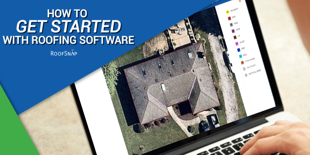
We’ve been measuring roofs from aerial imagery for a long time, and one of our favorite improvements to the process has been the addition of HD imagery into DIY measurements. We’ve made do with muddy satellite imagery in the past, but if you’ve ever imported drone imagery and measured off of a 12 MP camera or better yet brought a Nearmap image into your project, you know what we’re talking about. This week’s blog will take you through the benefits of bringing the absolute best images to your measurements.
No more playing “Where’s the Ridge”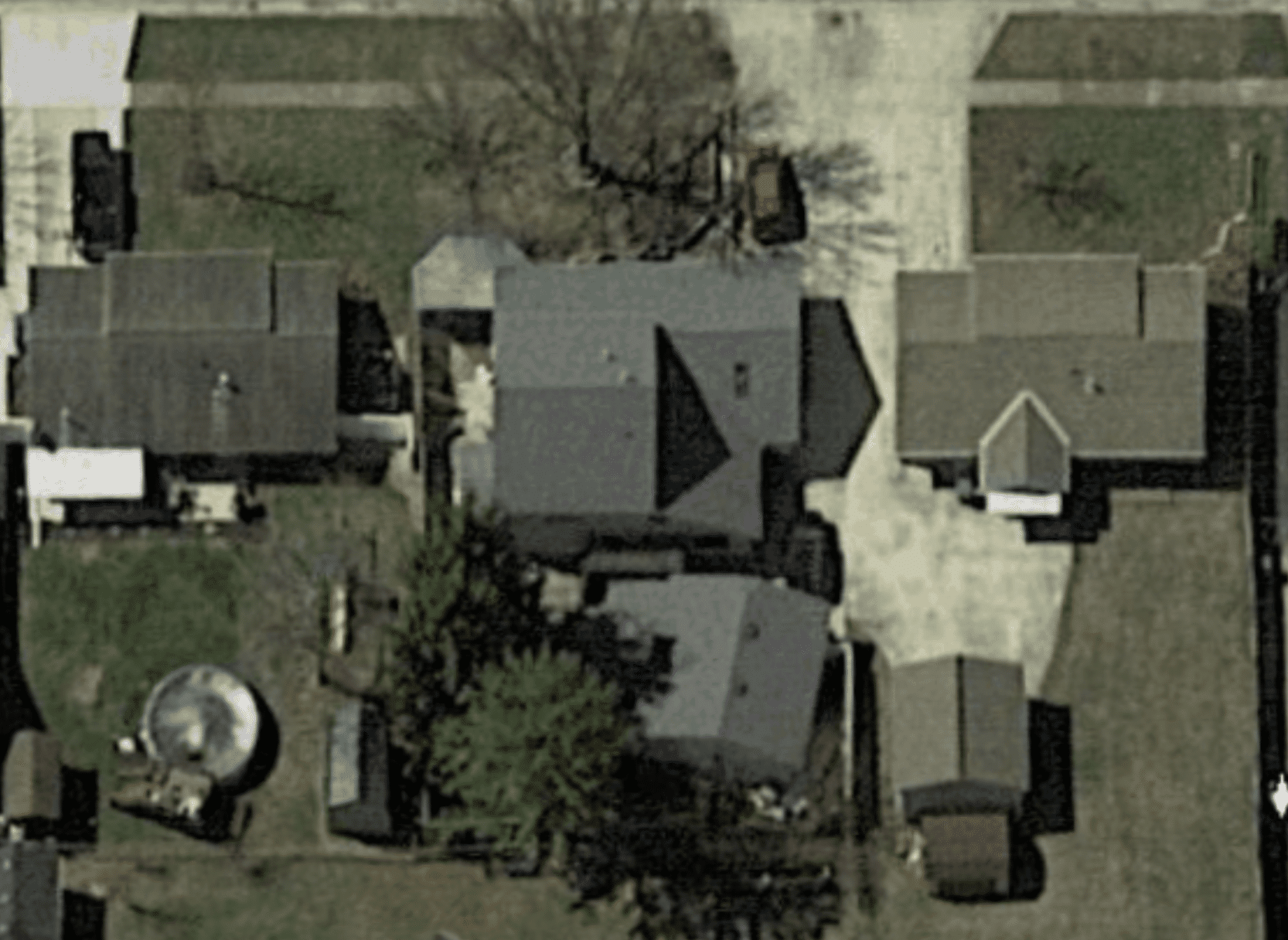
Many satellite photos boast passable definition. However, when the photo for your project was taken at the wrong time of day, or in the wrong season, passable may not be good enough. Many times we’ve seen satellite imagery taken during the morning or evening that left some facets of the roof completely in shadow.Now because RoofSnap offers different imagery options, as well as pitch-finding tools, there’s often a way to ascertain the shape of the roof in spite of this. But if you’d rather not have to hop into a 3D image to eyeball a certain section, the multiple fly-over dates that we offer from Nearmap are often an easier solution. Having options means you’ll find the perfect image to reveal all the details previously hidden in shadow.
Worried about trees? Puh-leez!
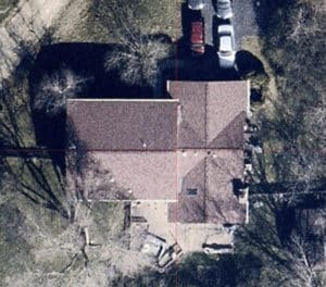
If you’ve been a reader of our blog posts this summer, you may recall our post about leaf-off imagery. Our company is based out of the Midwest (Ohio to be exact) and we have to say, a big oak tree can ruin our day when we’re trying to sketch. That’s another reason we love our HD imagery providers. All we have to do is take a stroll through the available imagery dates and find an image that was taken during Fall or Winter and suddenly the eaves that were shrouded in green can be easily seen! Try guessing where your linear measurements end under tree-cover at your own risk!
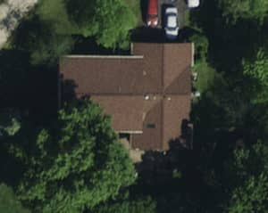
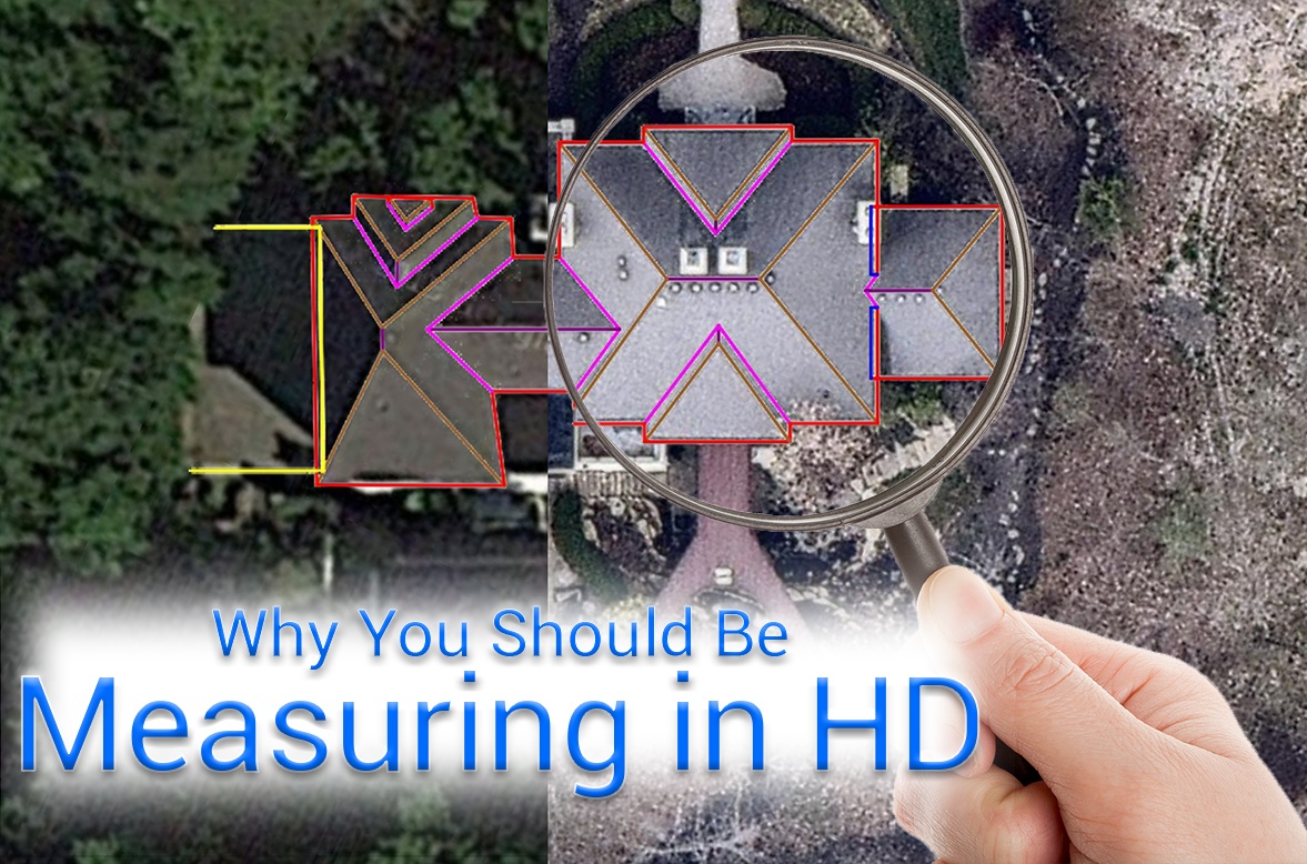
 Left: Tree obscured satellite imagery. Who knows what’s under those leaves?
Right: One of several fly-over dates that caught our pesky tree with its leaves off. Ooo-la-la!
Power up your presentation!
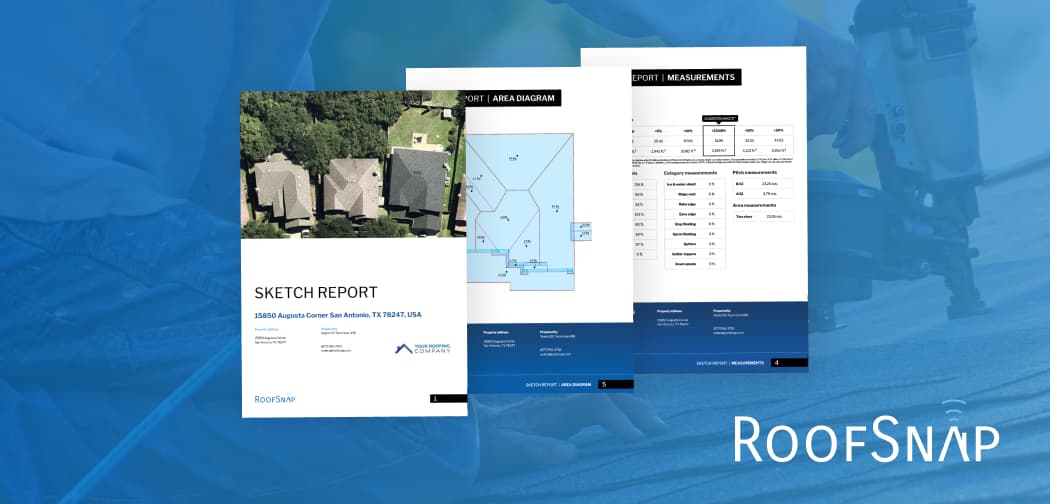
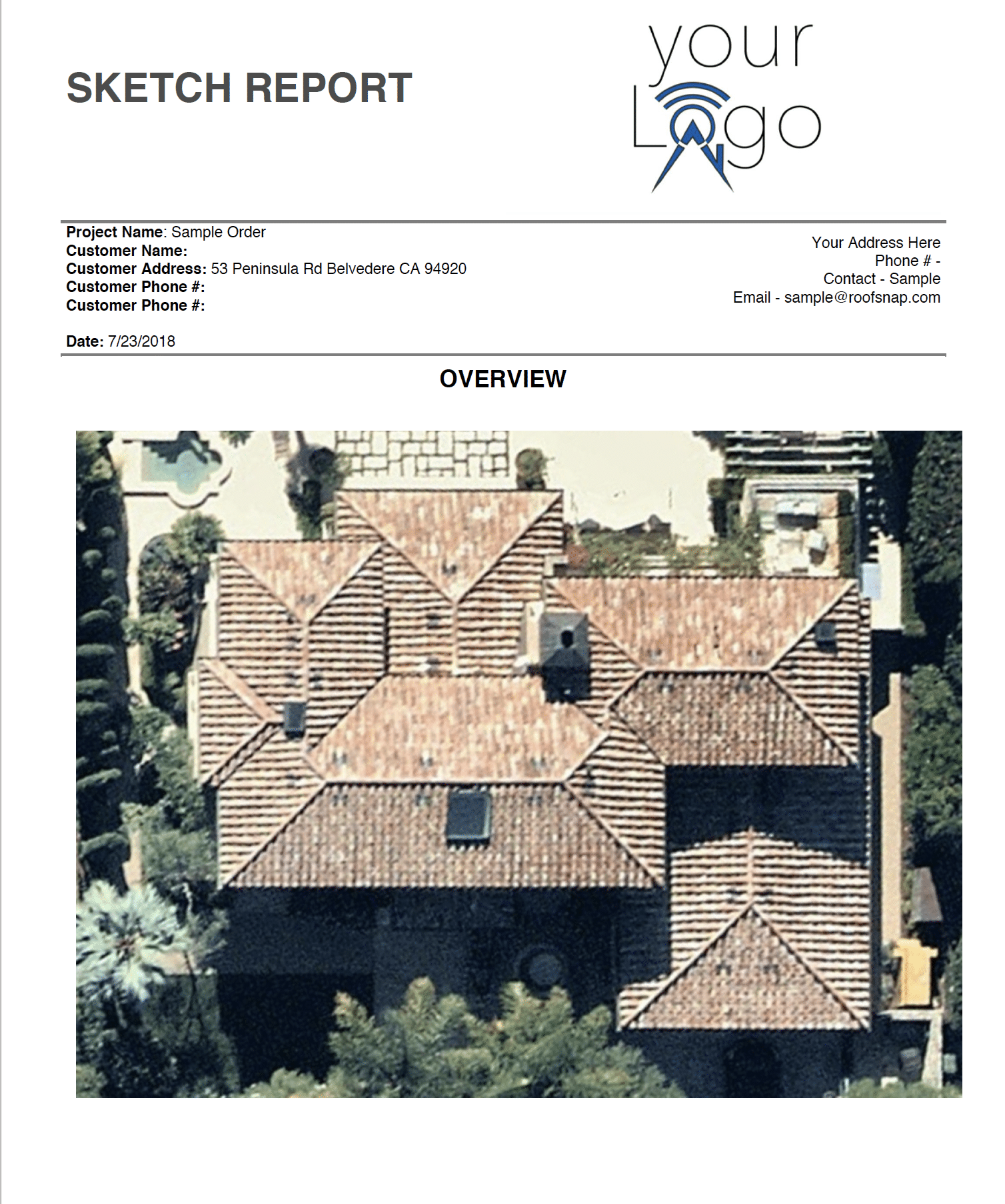
If you make a habit of sending your sketch reports to adjusters, or if you like to use RoofSnap as part of your sales presentation, an HD image is an easy way to take your report to the next level. Our Sketch Reports are always fronted by the primary image of your project, so having an eye-catching start to your measurement packet will help you with clients and adjusters alike. That’s why our SketchOS reports will always have a Nearmap image included, so you never have to worry about the imagery you’ll see with your turnkey measurement.
There are more reasons to measure from HD imagery: improved accuracy, more visible granular details, recent fly-over dates versus aging satellite imagery, we could go on ad infinitum! However, research shows that limiting posts to 3 main points helps with the reader’s attention spans so we’ll end our blog here today. We’d like to shout out our partners at Nearmap, their hard work and constant improvements are what makes their imagery so valuable, and we’re proud to offer it to our users at our subscriber-exclusive price points.
If you’re not a subscriber and would like to see what all the hoopla is about, we invite you to give our software a try and see what it can do for you! You can schedule a free demo or contact our support team at Support@RoofSnap.com and get any questions you have answered.